
I’ve launched a new studio project on the subject of water, which will consist of a combined process of running, writing, drawing, and creating installation works. The project has begun close to home, with the Casco Bay watershed. I’ve been researching throughout the summer, and yesterday I began in earnest, running the final leg of the Sebago to the Sea trail. The trail starts at Sebago Lake, the primary source of Portland’s water supply, and ends at Casco Bay. As with my farm running project of last year, I’m discovering that it’s easy enough to print a map and find a starting point, but navigating the hidden vision within someone else’s mapping process is often more complex.
The 7th and final leg of the Sebago to Sea trail runs from the Blackstrap Road Canoe Launch to East End Beach, and it combines, somewhat awkwardly, urban, suburban, and forested segments. I asked my friend Rick to join me on this first run, in order to facilitate the point to point running (a car on each end) and the navigation (I’m learning to run with reading glasses, but it’s a pain!). Also, Rick’s got good map sense and keeps the pace moving. The 7th leg of the trail is mapped out at 8.2 miles, but we found the urban bushwhacking to be difficult and added a few miles, due to hunting for the persistent transitions from woods to sidewalks and back (our final run was 10.08 miles). Difficulties aside, the process of meandering with a map in hand tends to offer surprising insights, and this was no exception.
We found the trail head, a tiny parking lot near the river in Falmouth, and were just about to start the run when a guy pulled in, hopped out of his pick-up, and started chatting. He had some time to kill while he was waiting for his wife and he’d been curious about the new trails. He looked around, commented on the un-artful graffiti tag on the trailhead sign, then began sharing some of his childhood memories of Portland. He talked about swimming in the “back bay” before it went through a period of being polluted. This gave rise to a debate about back bay vs back cove. According to our chatty friend, the yuppies brought the term back cove; however, it looks like he’s on thin ice with that argument. Yuppie is an 80s term, and History of Portland, published in 1865 by Portland mayor and state senator William Willis, is filled with discussions about the back cove. I doubt even this would convince our storyteller, as he was adamant! He went on to mention the practice of infilling for development and the related contamination of Portland’s water. He said he used to swim in the back cove until he saw sewage in the water. He also recalled his childhood when there was an ice delivery truck and his parents would leave a note for what size ice block they wanted. I told him that he looked good for 121 years old, as I can’t imagine ice delivery in 1940s Portland, though it probably existed! It’s interesting to note that the water lines of the back cove used to be significantly different, before the city expansion that began after the Industrial Revolution and after the fire of 1866. “Portland Then and Now,” an article on University of Southern Maine Osher Map Library website (with very cool maps), describes the infilling that occurred: “Several major land fills extended the urban core into Portland Harbor and up the Fore River to support commercial and industrial enterprises. New residential property was created by filling in the Back Cove.”


 We were ready to start our run, so we pulled out of the conversation, turned away from the wooded trail leading back toward Sebago Lake, and headed out onto the street. As we attempted to follow the map, aiming to arc back to the river, we ran through suburban developments that were completely desolate–a single oil truck grumbled by. We eventually reached the first section of wooded path, which led down to the
 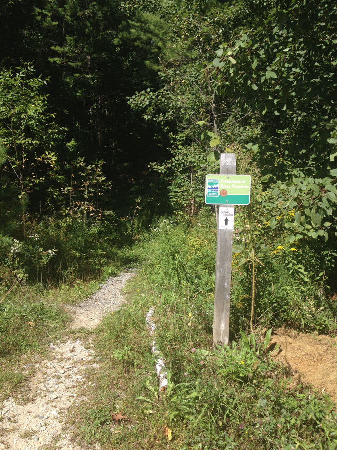 Presumpscot River and to the nicest part of the run. As we were looking for the right path, we spotted some Warhol-reminiscent graffiti under the bridge.


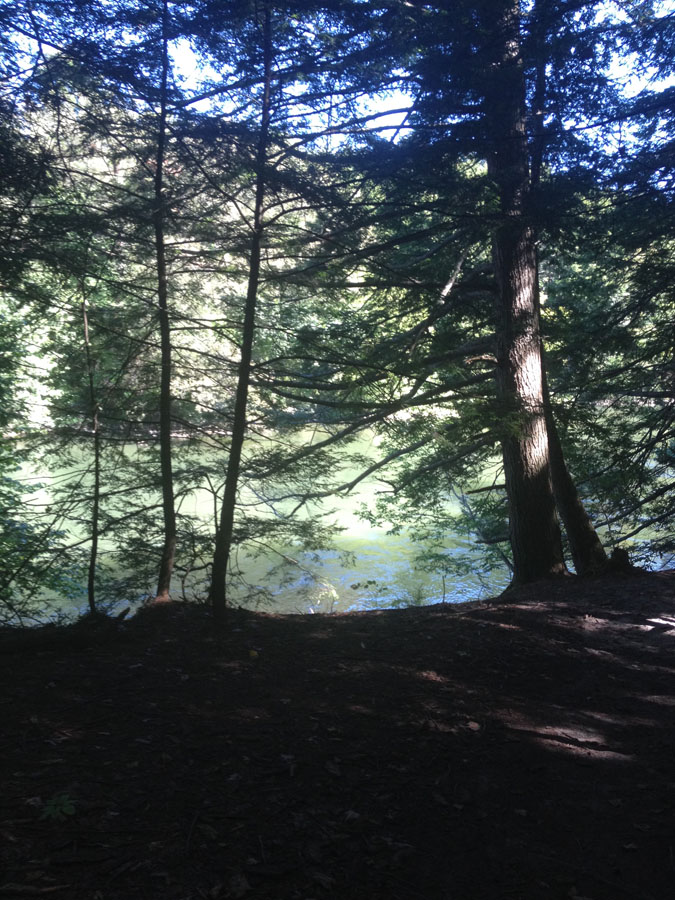
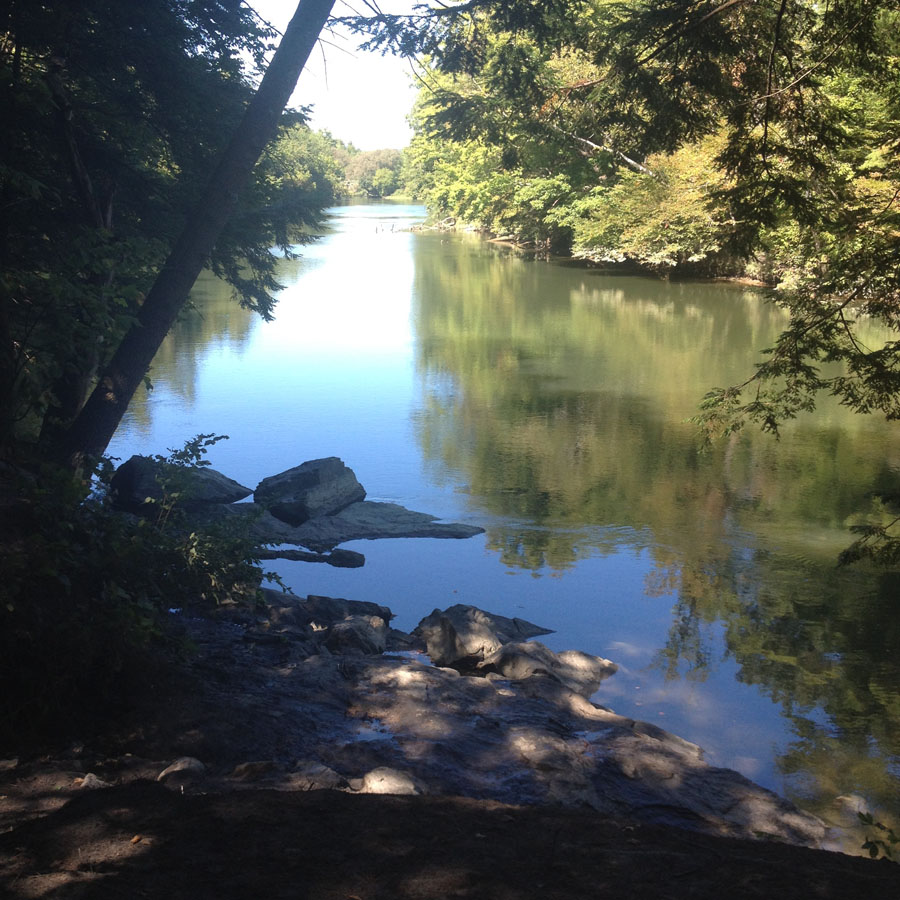
The path along the river was lovely–the green of the river glowing through the trees to our left. The trail was quiet but for one guy walking his dog and the sporadic sound of traffic in the distance. After a mile or so, we found the Presumpscot Falls and a sign describing the site of the Smelt Hill Dam, the first dam built in Maine, in 1734.
 The sign outlined how, in 1996, a flood irreparably damaged the dam. By 2002 the remains were removed, which restored the falls and the possibility for a healthy, diverse wildlife habitat.

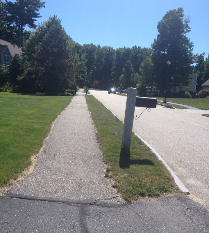
As we ran down river, it was hard to determine where the Sebago to Sea trail navigated out of the woods. We were enjoying the trail, so we stayed near the river until it intersected the bridge on Allen Avenue, at which point we scrambled up to the street.  From that point on, the trail led through schoolyards, sidewalks, roads, and paths, and it wasn’t until we were over half way that I realized that, in addition to scattered Sebago to Sea signs, discrete white blazes were marking our trail.
 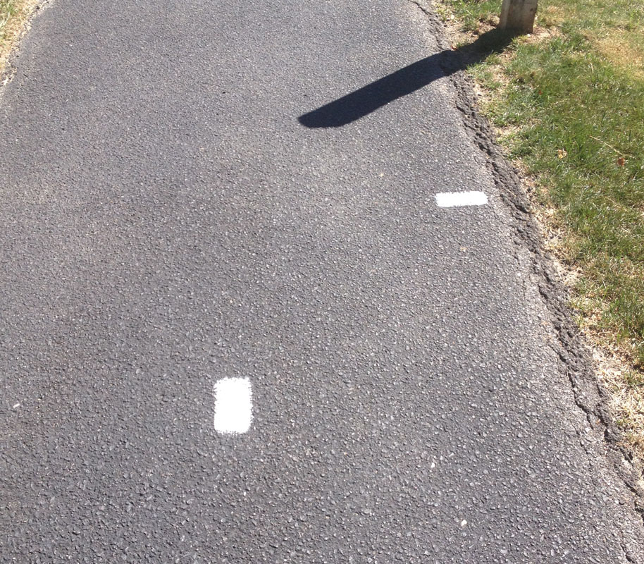 We followed the white dashes up Stevens avenue, at which point we realized that the blazes
  mark Portland Trails and aren’t specific to the Sebago to Sea route.
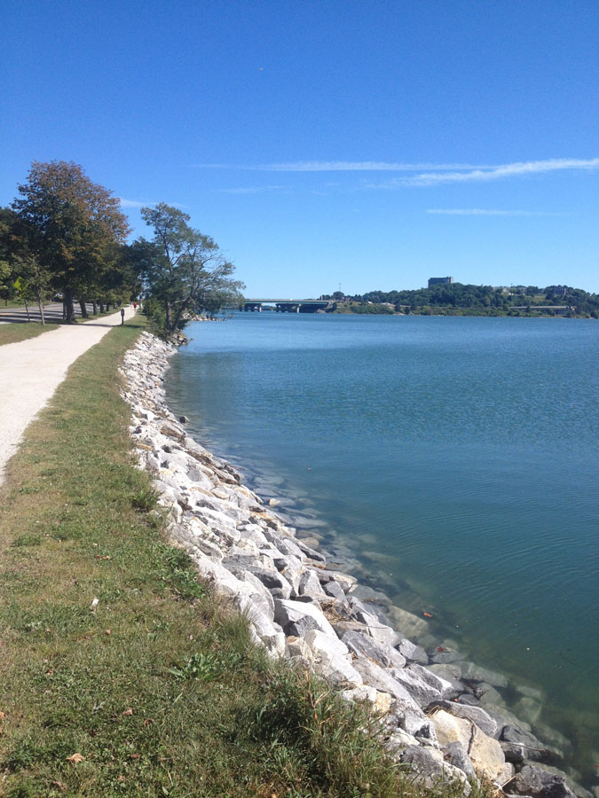
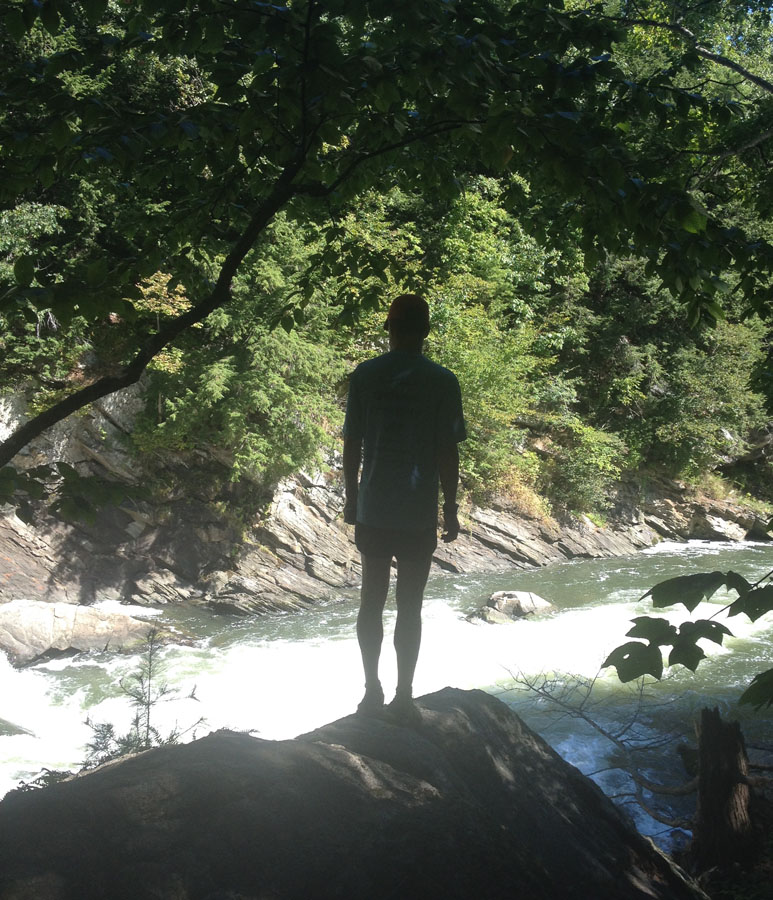
Having lost the trail, we turned toward back cove, knowing that we would intersect the mapped route on the Washington Ave side. It was a beautiful day for running, but still, I was wiped out and the blue-green water looked welcoming. We cruised along the familiar back cove trail, down the final mile to the East End Beach.

We soaked our legs in the water for a bit and then headed back to the starting point to pick up the car.
As I reflect back on the farm running experiences of last year, I’m aware that part of the process and pleasure of discovery was in getting lost while navigating someone else’s vision of a place—a vision with a different set of goals than mine (knowing one’s farm boundaries, locating fence lines, etc.). The same is true with the watershed exploration, and I imagine the board members, naturalists, and trail crew that developed these trails with the goal of “connecting communities.” As I experience  the trails and the water pathways that accompany them, as a way of understanding the Casco Bay watershed and the water resource that fuels Portland, I feel as if I’m in conversation with others who have looked at the land with care and intentionality for a range of reasons. I can’t wait for the next run and for the drawings that emerge out of the experience.


Pingback: Cosmic Cellar | lucindasrunningblog